Aegean Turkey: Troy to Bodrum

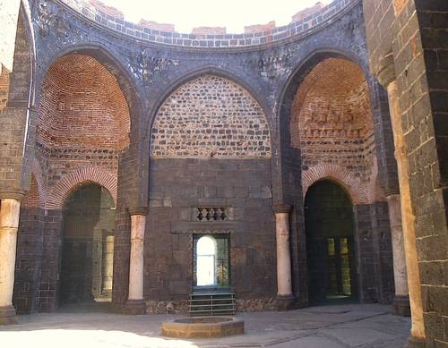
When Freya Stark was in this area in the early autumn of 1952, she was on a quest (the very word she used in the title of the book detailing her adventures: Ionia: A Quest). Armed with her Classics, she was looking for the material reality underpinning the narratives of the likes of Herodotus and Pindar. As far as she was concerned, she was in Ionia (the other component of the title), sometimes in Aeolia, occasionally in Caria. She never doubted that she, like the antiquarian travellers before her, was in an extension of ancient. Her experience remains unique: travelling as a woman, a foreigner and on her own, she aroused curiosity and a sort of protective sympathy. She had a novelty value that made her feel occasionally like an animal in a zoo but which at times secured VIP treatment from the local poeple. Archaeologically was not ready for her (hence her disparaging comments on the state of the theatre at Pergamon). Transportation was not easy; the crossing of the Meander Delta, some 8km wide, entailed the use of a lorry, a tractor, a ferry and an overnight stay. She came across only one visitor on the same quest as hers, and yet she toured 55 sites.

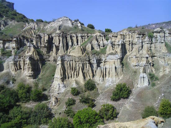
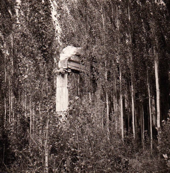
Sixty years on, things have changed in many respects. For a start, today you will not be alone, probably not even in the depths of winter (the climate on the coast can be benign and Turkish pensioners use timeshares for a week in the sun when the tourists are away). And in the high season, tourists come not in units but in millions. Despite the efforts of the Turkish government to rebalance and diversify tourism away from the Aegean and Mediterranean and direct it more to the interior (set out in a document detailing the strategy for 2023, the centenary of the Republic), it may prove difficult to persuade holiday-makers to eschew the beaches. As far as archaeology is concerned, the region has been made ready for mass consumption. When I was here in 1969, it was still possible to photograph, not far from the main road, a couple of marble Ionian columns topped with an architrave. They stood sprouting from an overgrown field like an improbable weed. Now archaeological remains have either been obliterated by development, neglect, stone robbing or ploughing or they are fenced off, restored, reconstructed and signposted. They come with a bekçi (custodian), an entry ticket and a visitor centre. Bodrum and İzmir have major airports, which means you can bypass Istanbul altogether, and the roads have improved enormously—though the topography still makes for some interesting driving. Crossing the Meander, at any rate, is no longer a challenge.

Aeolia, Ionia and ancient migration
The idea that the east coast of the Aegean was systematically colonised by mainland Greeks, i.e. by would-be colonists under the leadership of a hero, is deeply engrained. Travellers, including Freya Stark, and archaeologists working on location, have all taken it as a fact. The ancient sources, albeit with a number of variants, agree that the Aeolians, a few years after the Trojan War, set out from Thessaly (or was it Boeotia?) under the leadership of Orestes, son of Agamemnon, to settle in Lesbos and on the coast north of the Gulf of İzmir. Four generations later the Ionians, fleeing the invading Dorians, occupied the coast south of İzmir as well as the islands of Chios and Samos. They had strong support in Athens and the enterprise was eventually presented as an Athenian triumph. Each ethnic group was organised into a federation of twelve cities. The Aeolian League had its seat at the Temple of Apollo at Gryneum; and the Ionian League had theirs at the Temple of Poseidon on the Mykale peninsula.

All this accorded well with the colonial attitudes of the late 19th century, when excavations began. After the Bronze Age, it was reckoned, progress could only have come from the West. However, as archaeological research continued, the evidence to back up this narrative failed to materialise. There is no trace in the Archaic material of a single dominant group either north or south of İzmir; no trace of new arrivals; no changes in the pottery.

Archaeologically speaking, an Iron-Age Greek migration into western Asia remains invisible. A re-evaluation of the sources was thus long overdue. It is interesting that Homer (7th century BC), who was well placed in İzmir, at the supposed junction of the two ethnicities, has nothing to say on the matter. No Aeolia, no migrations. The information comes later, and the later it is, the more detailed and complete. Strabo, in the 1st century of our era, gives the fullest account. On the ground, however, archaeology for the 7th century BC shows a very reduced Greek presence on the coast, with Phrygians and Lydians dominant in the hinterland. The leagues, it has been suggested, were not an expression of ‘being Greek’ but a way to cope with the patchwork of diverse ethnic groups that had occupied the space left by the demise of the Hittite Empire. About the same time, the expansionist policy of Miletus, up the coast and into the Black Sea, encouraged Athens to do likewise and set up a colony at Sigeum in the Troad, as close as possible to Troy, which was taking off as a cult centre celebrating Homeric heroes. Identities were being established with the assistance of made-up genealogies; new identities were forged as a reaction. The climax came with the Persian Wars at the end of the 5th century BC, when Athens was able to establish its primacy. It is then that Ionia (Aeolia had by then faded) looked west for leadership and the migration myth was crystallised. In the Hellenistic period Troy, Priene, Pergamon and Sardis all organised games in imitation of the Athenian Panathenaica. Architectural styles converge and Athens emerges as the mother of them all. The triumph of Ionia lives on today in the Turkish word for Greece. Yunanistan.

Aegean Turkey: From Troy to Bodrum, by Paola Pugsley, is the latest in the series of updated chapters from Blue Guide Turkey. It will be published in spring 2018.

The Black Fields of Kula

East of Sardis, the black fields of Kula extend for some 1800 square kilometres, roughly south of the Gediz Valley to the towns of Katakekaume (today’s Kula) to the east, and Alaşehir, the ancient Philadelphia, to the south. They were praised in antiquity for their fertility: the wine, the Katakekaumenites caught Strabo’s attention (13.4.11). These days there are still vineyards, but the wine is strictly for export. Geology is the raison d’être of the place today and is what hopefully will put Kula on the tourist map.

The black fields are the result of comparatively recent volcanic episodes (roughly 10,000–15,000 years ago). Turkey is not short of volcanoes: think of the Erciyes overlooking Kayseri or of the Nemrut and the Suphan on the west edge of Lake Van. Here, however, everything is small, almost miniature, lending itself to the creation of a geopark. The Kula Volcanic Geopark, complete with UNESCO blessing, covers a number of sites dotted over an area of 300 square kilometres, where one can observe at first hand textbook examples of phenomena related to volcanism.

An infrastructure of trails, walkways, shelters and explanatory panels has been set up to guide people around; tour guides are being trained. On offer are extensive lava fields, barren, black and forbidding, in places several kilometres deep, now eroded into strange shapes and overlooked by cinder cones complete with craters. Lava caves and lava tubes are another feature of interest: they are formed when the lava flow develops a hard exterior crust while inside the hot stream is still flowing. In other places the lava cooled rapidly, forming basalt columns. The area’s bedrock is limestone. The flow of the hot lava has resulted in a modification of its chemistry in the contact area; it is in this way that marble is formed. Spectacular dykes show where the lava found its way into fissures: black snakes into white limestone. Erosion played its part here as well, creating a nursery of hoodoos (fairy chimneys) where one can see how they form and eventually topple over. The list is long; there are even fossilised human footprints in the cooling ash.

Back in town, the unusual geology of the black fields is apparent in the 18th-century Ottoman houses, all built in stones of a bewildering variety. A number have been lovingly restored and are open to the public. One is a guesthouse (Anemon Otel). A well-appointed museum in the main square rounds up the visit with hands-on exhibits, explanatory panels and maps.

One can only wish plenty of luck to such an ambitious project. It might prove an uphill struggle to entice tourists to see ‘just stones’ (to quote a disappointed visitor). But for anyone interested in the ground on which monuments stand this is a must. At the moment the site is little advertised. Anyone arriving in Kula would be hard put to to find it. The solution is very simple. This writer went to the police and found the trail with a police escort via a sequence of secondary unmade roads while a guide was summoned. The trails are ready but not the roads. Anyone wishing to visit without a police escort should ring Ali Karataş on 05432 177 581. He is the head of the guides and he will give you a guided tour in English.

by Paola Pugsley. Paola is the author of four Blue Guides ebooks on Turkey. She is currently working on a volume covering the coastal area between Troy and Bodrum.

The many lives of Nasreddin Hoca

Nasreddin Hoca is the darling of the souvenir shops. More or less all over Turkey one can find the figure of the rotund sage with his outsize turban and huge prayer beads, on books, statues and statuettes and a variety of objects. His philosophy, with its touch of the absurd and at the same time faultless, infuriating logic, is alive and kicking—so much so that to this day new Nasreddin objects are invented to supply a market that is clearly thriving. The last on the list is a clock that goes backwards while still telling the time correctly. Nasreddin himself was fond of playing with the subjective idea of direction. He would not be faulted for riding backwards on his donkey since, according to him, it was the animal that was facing the wrong way. And so the legend grows and grows. Generation of children have been brought up on his moralising tales while the saucier stories feature in adult conversations with innuendoes that all, at least all Turks, can follow.

The man himself is a bit of a mystery. It is not even sure that he ever existed. Experts have pored over all the stories that are attributed to him and agree that he must have lived somewhere between the 13th and 15th centuries. Tamerlane, the man from the east who plunged Anatolia into chaos towards the end of the 14th century, features in one of his tales. The general consensus is that Nasreddin is the expression of the popular wisdom of the Anatolian peasant caught up in the conflicts between embattled Byzantines, insurgent Turks and conquering Mongols. The battlefield was always the same: Anatolia. Its peasants bore the brunt of the havoc created by the clashing armies. Humour was one answer, possibly the only one available. Today the Byzantines are no more, the insurgent Turks have been tamed and the Mongols have gone back home. The Anatolian peasant is still there.

Over time the legendary Hoca has been given some flesh and bones. The Ottomans started the ball rolling in 1905 when a kiosk was built enclose the so-called tomb of the sage in Akşehir. The town developed as a Nasreddin destination complete with a ‘centre of the world monument’ and more recently a park containing lifesize images of his stories, including a gigantic cauldron that featured in ‘The Cauldron that Died’. The giant trestle enabling tourists to be photographed wearing the Hoca’s trademark outsize turban is unfortunately no more. Akşehir, a town otherwise of little interest, did well by the tourist trade until a nearby rival, Sivrihisar, entered the scene. There is nothing to link Sivrihisar to Nasreddin Hoca (at least nothing that can be historically proven) and the same applies to Akşehir. Yet now they claim to have a tomb with his and his daughter’s bones, proof positive that he was born there when the town was called Hortu, as well as his house, still standing 800 years on (quite a feat for a wood and mudbrick structure).

Recently yet another contender has thrown its hat into the arena, giving the Hoca’s story a complete new twist. In Ankara, as you leave the railway station, you are welcomed by a statue. There is something uncannily familiar about it. The huge turban, the backwards riding position: we have seen this before. But Nasreddin is not on a donkey. Instead he is riding a Zincirli neo-Hittite lion, genetically twinned with a sphinx, hence the wings. The tail is that of a snake. Suddenly the sage has been pushed back a couple of thousand years, if not more. The sphinx is an Egyptian connection and harks back to the Hittites who had close contacts with them. Those were the good old days, when the king of the Hittites could look the pharoah in the eye, call him ‘my brother’ and give him his daughter in marriage. Suddenly the Turkish presence in Anatolia lays claim to stretch back that far, though historically it is known that Turkish tribes began infiltrating the Byzantine Empire from the East in the early 11th century. It is entirely appropriate that this pastiche of a monument should be in Ankara, the city from which Atatürk made his bid to supply the emerging Turkish nation with a glorious past dating back to the dawn of time. He was not interested in a merely Islamic past. Instead he bent the archaeology and the historical evidence to his aims—and although recently Ankara has somewhat reneged on this legacy, as the disagreements over the city’s emblem show, the rejection of it is clearly not one hundred percent.

by Paola Pugsley. Paola is the author of three ebooks on Turkey, published by Blue Guides. Her Central Anatolia with Cappadocia is currently in preparation.

Tea (or coffee) with the Sultan

When you next order a Turkish coffee, have look at the glass of water that normally comes with it. If you are lucky, it will have an elegant sweep of curvy gold lines on it. You will easily recognise it: this is a tuğra, a sultan’s cipher and now a symbol of Ottoman Turkey. Putting it on glasses is just a fashion. A trip to the bazaar may enable you to come home with a tea set in the tulip shape or just a few plain, elegant water glasses, all emblazoned with tuğras. But what is the origin of the artwork? Opinions are deeply divided though there is a fair chance that the original design goes back well before the Ottomans who brought it to perfection.

There are basically three main parts to a tuğra. The stand, that is the base, contains the name of the sultan, his filiation and the title ‘ever victorious’ (el muzaffer daima), all in Arabic script; to the left two concentric ellipses  (the eggs) run in parallel lines to the margin of the paper to the right (the arms). Finally three vertical strokes with or without curvy pennants occupy the centre. The vertical strokes seem to hold the key. They may represent the handprint of the sultan or indeed the mark of his three fingers dipped in ink and trailed on the document. Unconfirmed reports speak of one such example in the archives of Ragusa (now Dubrovnik), from the hand of Murat I in the mid-14th century. But some think one should look further back, to the time when the people of central Asia were roaming the steppes with their flocks. Branding or any other way of telling the animals apart, would have been a necessity. According to Raşid-al-Din’s historical compilation, the Turkish and the Mongol people used a mark (tamga) both to stamp their decrees and brand their flocks and herds. Each of the 24 Oğuz tribes, the founding fathers  of the Turkish nation, had its own logo, a combination of vertical and other strokes. That’s where the arrows come in. Arrows play an important part in early Turkish history as an expression of power. Archery was an important factor in their military success. Oğuz Turks traditionally belonged either to the ‘Great Arrow’ (Bozok) or to the ‘Three Arrows’ (Üç Ok); in addition, the election of the early Seljuk sultans apparently included a ritual based on arrows.

With the Ottomans the tuğra (which probably existed at the time of the Seljuks though there are no concrete examples, only text references) became codified as a symbol of power, the sultan’s signature. He did not draw it himself: a dedicated school of calligraphers was in charge. As the firmans (the sultan’s official decrees) multiplied, the artwork was simplified and standardised while at the same time embellished with the application of gold and colour. With time the sultan’s mark made its way onto coins, flags, stamps, passports, official monuments, buildings and warships.

Beyond the Ottoman Empire, tuğras are known in Iran, with the Great Seljuk; in India at the time of the Mongols; and in Egypt with the Mamluks. A unique example not connected to the Turkish community has been traced in the Crimea. In 1836 the governor issued a passport to a Polish doctor on his way to work in Istanbul. It bore the tuğra of Czar Nicholas I, probably modelled after a coin, and was intended to add authority to the document and ensure that Ottoman officialdom would supply the three horses and the necessary assistance to enable doctor Radzionski to reach his destination as soon as possible.

by Paola Pugsley. Paola is currently working on a guide to Cappadocia and central Anatolia. For her other Turkish titles, published digitally by Blue Guides, see here.

A tale of three museums

Turkey has a comparatively long history in the business of setting up museums. As early as 1869 the decision had been taken to create a purpose-built Imperial Museum in Istanbul, grand enough to rival the Louvre in Paris. The idea was that provincial governors would fill it up by forwarding the best findings from their areas—from all over the Ottoman Empire, which was pretty extensive at the time. Under the leadership of Osman Hamdi Bey, a man of many talents, the scheme was very successful. Such was the success, in fact, that in places like Crete, the local assembly with jurisdiction over cultural affairs refused to grant excavation permits until the island had been freed of Ottoman occupation. It feared, quite rightly, that the finds would immediately be whisked off to Istanbul.

The rectangular building at Şanlıurfa

With the establishment of the Republic in 1923, the focus necessarily changed. Ankara was the new Turkish capital: Anatolia was centre stage. The Museum of Anatolian Civilisations willed by Atatürk—although  it opened well after his death—was to be the showcase for the true land of the Turks, the high plateau. There again the scheme was grand, well in tune with the intended destiny of what was then a rather run down, impoverished town. And once again the provinces, this time of the newly founded republic, supplied the artefacts to go in the display cases.

With the dramatic  development of Turkish archaeology in the wake of the salvage excavations linked to the country’s extensive dam-building programme, some local museums were also established—but on a small scale, truly provincial. All this has changed now. The three main cities of the southeast, Şanlıurfa, Gaziantep and Diyarbakır have joined in a race to outdo not only each other, but Istanbul and Ankara too.

In Gaziantep the Zeugma Mosaic Museum leads the way, with its caravan of concrete camels (for more on this, see Blue Guide Southeastern Turkey). It was opened in 2011. Stark and white, constructed in a bunker style, it must have looked very large when it opened just three years ago. But it will be dwarfed by the new Şanlıurfa museum.

Situated in the northern part of town, the Urfa project is on a different scale. For a start this is a double museum, with one main rectangular building and a sizeable circular construction next to it housing Hellenistic and Roman mosaics of exquisite quality. Westerners may be excused for thinking of ‘cathedral and baptistery’, but that was certainly unintended. If anything, the gigantic rectangular building (at least from a distance) looks like one of those mudbrick Mesopotamian temples with engaged pillars. Close up one can see that it is all built of limestone, partly clad with brass. Both museums are currently unfinished, and every time you make an enquiry, you get a different completion date. Signs of activity are muted. The building structures themselves are probably complete. The problem is the surroundings. Both structures sit in a landscape of utter desolation. Urfa has historically expanded towards the east. The northern part of town where the new museum is has never been an active or a busy area. The bus station was here and over time the district came to be occupied by shanty buildings, those gecekondu, ‘built overnight’ as the Turks graphically put it, and a cemetery. Now, however, the bus station has been relocated to shining new premises out of town. A four-lane highway has been driven through the district and the shacks have been bulldozed—at least partially. One can see where the demolition work came to a halt, the scars of unfinished work with more shanty buildings beyond. One cannot help making a parallel with the recent protests in Brazil about ‘world class facilities and world class services’. Even so, the people in Urfa are proud of their museum and, by the look of it, would rather have that than other amenities the money might buy.

Soon to be a restaurant: the Artukid palace in Diyarbakır.

In Diyarbakır the scene is similar and yet different. No new structure has gone up here. Instead the museum is part of an ambitious plan to renovate and spruce up the citadel overlooking the Tigris in the east of the walled town, specifically the older part, beyond the Artukid arch. Occupation here goes back to the beginning of time. Indeed it is only by exploring the area that one understands why Diyarbakır is where it is. Nowhere in the town centre does one catch a glimpse of the river. It is totally immaterial to the life of the modern town. Here on the extreme eastern corner of the citadel, however, or better still from the outside, one can see the precipitous basalt drop, affording a strategic location from which river traffic could be controlled. It all started here. Over time the citadel underwent many alterations and the final makeover was Ottoman, after which it was allowed to gently decay as the town expanded outside its walls to the north  and west. People moved in and the usual shanties went up. A large courtyard building was turned into a police station-cum-prison. Municipal open-air swimming pools resonated with the shouts of excited teenage boys. The countryside crept in as well. An old lady still had a cow tethered by her front door as late as 2011 and a chicken-farming business was set up outside, between the walls and the river. The coops are still there but the birds have flown. All this is set to change. Work has been going on for about a decade. The citadel is to be frozen in its Ottoman garb and the police station will be an archaeological museum (the awkward discovery of modern human skulls has been explained away; see Blue Guide Southeastern Turkey). Other buildings will house administration and services, a children’s museum, an art museum and other facilities. The beautiful Artukid palace is to be a restaurant, where one will be able to dine in style under the stars (mercifully the collapsed ceiling will not be reconstructed). Presently progress is slow, though, and the promised completion time of five months seems unrealistic. One looks around: workers are very few. They may wear Unesco-style T-shirts (Diyarbakır hopes to get the citadel listed as a World Heritage Site) but that does not seem to inspire them with Stakhanovite zeal. There is still much to be done. The museum area has been cleared of private buildings but not the rest of the citadel. Structures have been demolished, or half demolished, but people still live in them, at least judging by the peppers and aubergine skins strung up to dry in the sun and the neat piles of wood ready for the freezing winter. It would not be possible for officialdom to drive through that. There is only so much that authoritarian, top down planning can do. So far, a lot of money has been spent: recouping it through tourism will be a mighty challenge. Whatever benefits such grand schemes will accrue, they will not be for the people whose livelihood has been disrupted. They may even ask: why should the past dwell in a mansion and the present sleep in a shack?

By Paola Pugsley, author of Blue Guide Eastern Turkey, Blue Guide Southeastern Turkey and The Black Sea Coast.